|
Home
Up
News
Products
Services
Partners
| |
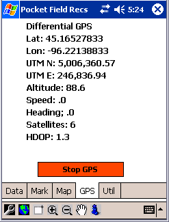
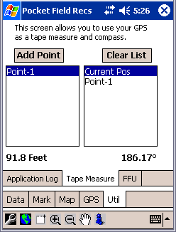
Pocket Field Recs is a data collection package for collecting
field data such as, boundaries, tile lines, weeds, soil sample points etc.
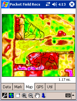
It also displays background data for navigation in the field for zone soil
sampling, etc.
 |
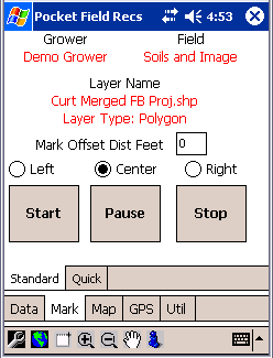
- Data is organized by Grower and Field.
- Under each field is a directory for holding data.
- The directory can hold any type of file, but only SHP
files, BMP files, and JPG files are currently supported for display.
- Folders can also be created for further storing data of
different categories.
|
Key Benefits
- Collects and Stores data on the Pocket PC in industry standard
formats, no external conversion utilities are needed.
- Easily integrates Image and Vector Layers, on the display. Supported
image formats at this time are JPG and BMP.
- Drawings are all in ESRI SHP
format.
- Organizes data into a neat structure by Grower and Field. Since the
data is in industry standard formats this data is easily used by other
GIS applications.
|