Yield Potential Mapping
|
Yield Potential Mapping
|
|
|
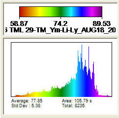
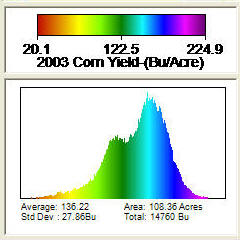
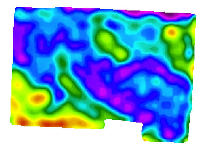
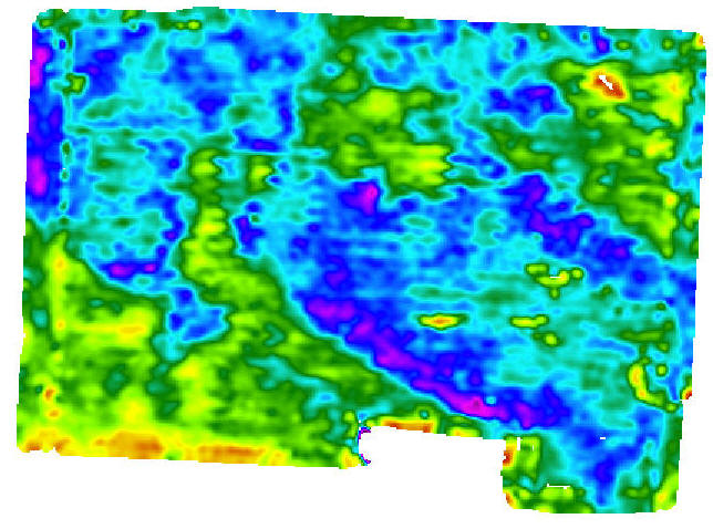
Satellite imagery or yield data is used to define variable yield goals across a field. Yield goals are used with variable soil test layers to create nutrient maps.
Notice the values of the map are different but the imagery helps us define good vs. poor yielding areas in a field. |
|
|